1/14


São Paulo Metro - Official
1K+İndirme
37.5MBBoyut
12.1.10(18-12-2024)En son sürüm
DetaylarİncelemelerSürümlerBilgi
1/14
São Paulo Metro - Official açıklaması
"São Paulo Metro - Resmi" uygulaması Metro sistemini kullanarak São Paulo civarında randevu ve nişan için rotanızı harita ve planlamak için en hızlı yoludur.
METRO - Uygulama São Paulo Büyükşehir Demiryolu Şirketi bir girişimdir.
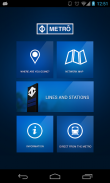
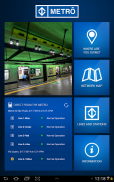
Fonksiyonlar ve kaynakları:
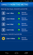
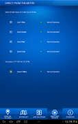
- Metro Doğrudan
Her satırı operasyonel durumunu gerçek zamanlı izleme.
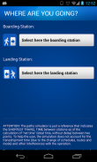
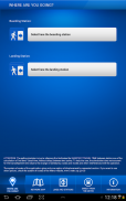
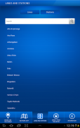
- Nereye gidiyorsun?
Tahmini süre ve maliyet olmak üzere iki istasyonu, mahalle haritalar, vb arasında en hızlı rota bir adım-adım simülasyon
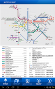
- Ağ Haritası
Tüm Metro hatları görsel haritası.
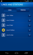
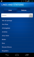
- Hatları ve İstasyonları
Tüm Metro hatları ve istasyonları görüntüleyin. Çalışma saatleri, yerleri, vb danışın
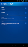
- Bilgi
Bireysel istasyonları ücretleri, yardım telefon numaraları ve saatleri görüntüleyebilirsiniz.
São Paulo Metro - Official - APK Bilgisi
APK sürümü: 12.1.10Paket: br.com.metrosp.appmetroAd: São Paulo Metro - OfficialBoyut: 37.5 MBİndirme: 393Sürüm : 12.1.10Yayın Tarihi: 2024-12-18 02:55:42Min Ekran: SMALLDesteklenen CPU: x86, x86-64, armeabi-v7a, arm64-v8a
Paket kimliği: br.com.metrosp.appmetroSHA1 İmzası: A7:68:BD:17:EB:0A:21:34:93:D9:D7:01:60:23:07:A5:A2:70:6C:1EGeliştirici (CN): Companhia do Metropolitano de São Paulo - MetrôKurum (O): Yerel (L): Ülke (C): Eyalet/Şehir (ST): Paket kimliği: br.com.metrosp.appmetroSHA1 İmzası: A7:68:BD:17:EB:0A:21:34:93:D9:D7:01:60:23:07:A5:A2:70:6C:1EGeliştirici (CN): Companhia do Metropolitano de São Paulo - MetrôKurum (O): Yerel (L): Ülke (C): Eyalet/Şehir (ST):
São Paulo Metro - Official uygulamasının en son sürümü
12.1.10
18/12/2024393 i̇ndirme37.5 MB Boyut
Diğer sürümler
12.1.9
10/6/2024393 i̇ndirme37.5 MB Boyut
12.1.4
29/2/2024393 i̇ndirme37.5 MB Boyut
2.7.6
15/12/2022393 i̇ndirme40 MB Boyut
2.4.6
5/6/2018393 i̇ndirme30.5 MB Boyut


Aynı kategorideki uygulamalar

Hoşuna gidebilecekler...

English


